Eventually, you will reach the summit and some of the best views you will ever see on a California summit.
Details
- 7 miles round trip
- 3,100 feet of elevation gain
- Usually hiked in the summer but start early, there is no shade
- Parking right near the entrance to Yosemite National Park
Getting There
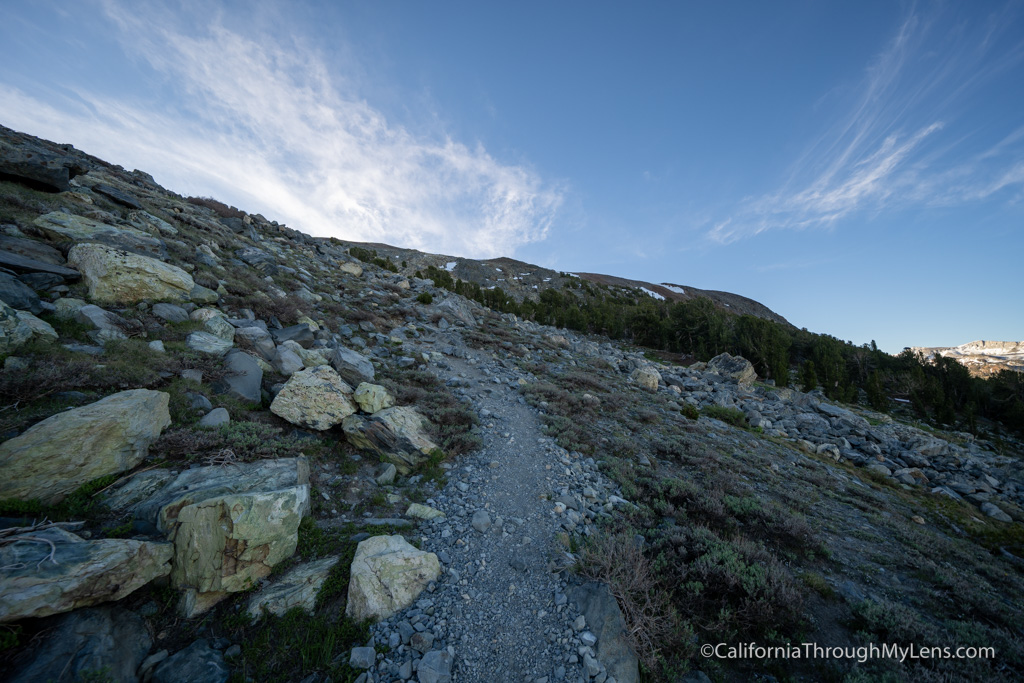
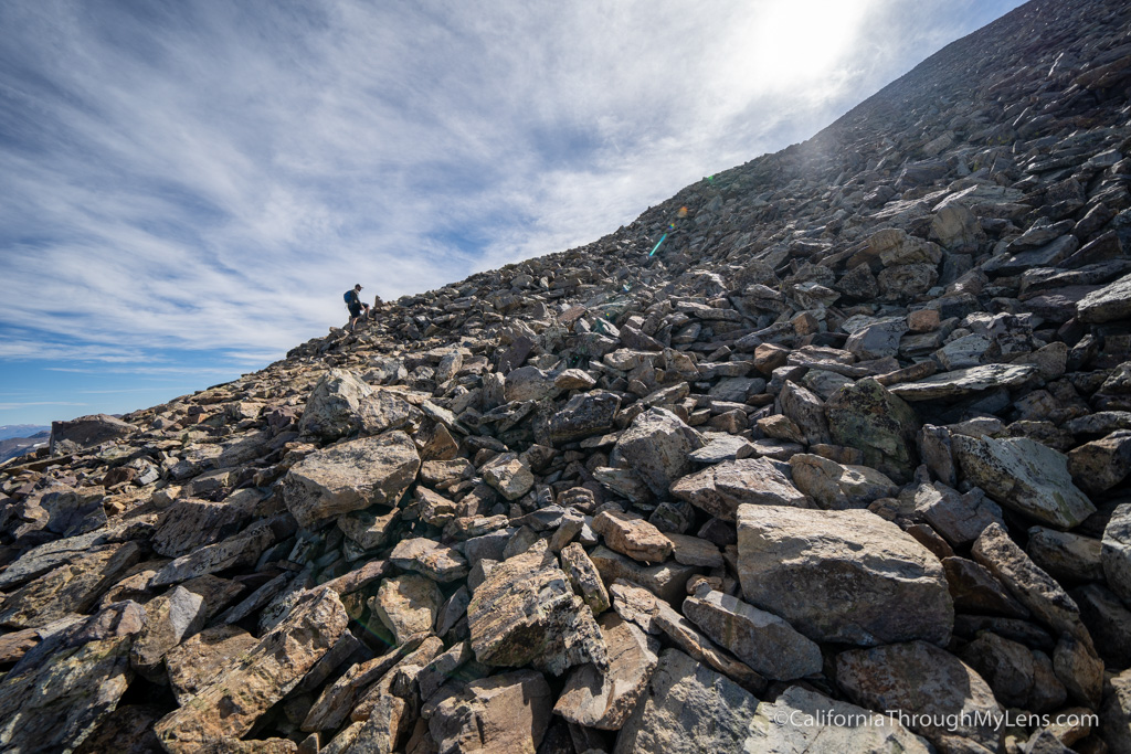
From here, you will be at the most challenging part of the trail as you will gain over 1,000 feet of elevation in less than 3/4ths of a mile.
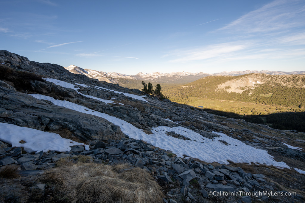
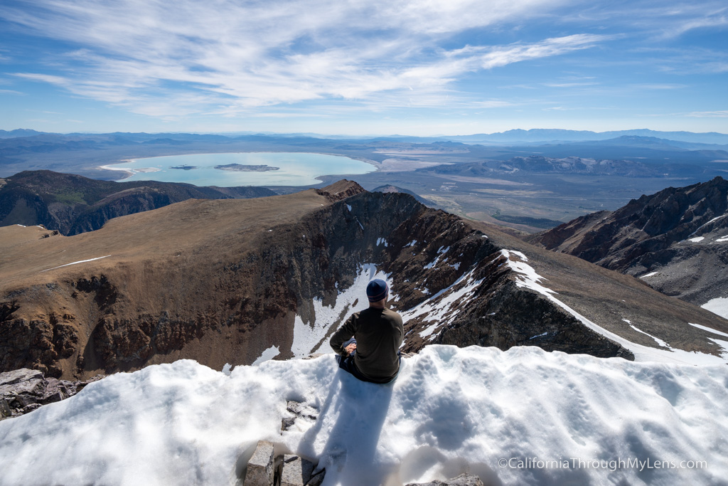
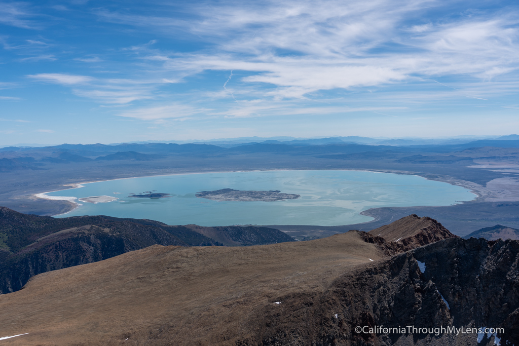
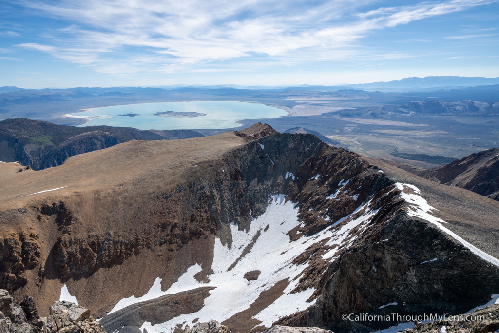
The peak has a fantastic amount of prominence, and you can see all the way down to Mono Lake and Highway 395 from the summit.
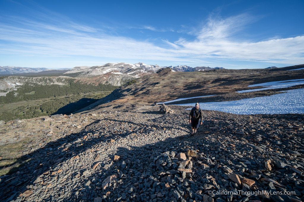
This section is relentless; it is steep with lots of rocks you have to hop as you make your way up.
Mt Dana Trail
Mt Dana is the second tallest mountain in Yosemite National Park, sitting just 60 feet below Mt Lyell. At 13,060 feet, it is a commanding presence in the Tioga Pass area of Yosemite’s backcountry. While it is technically a short hike at less than 7 miles round trip, it is very tough with an almost relentless uphill slog that climbs over 1,000 feet in the last 3/4ths of a mile. Once you reach the top, you are greeted with one of the best summit views in California, with the backcountry of Yosemite one way and Mono Lake and Highway 395 the other way. Here is all the information on this fantastic summit hike in Yosemite National Park.
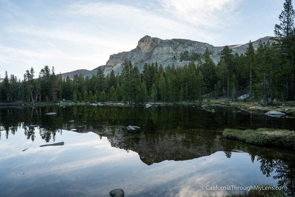
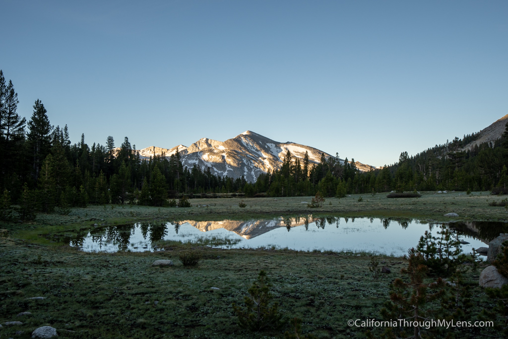
Along the way, you will see a few different lakes that have some stunning views in the early morning light.
Here is a video I made on the trail as well.
At the end of the day, you are just going up, and all paths are pretty much the same, stepping on large rocks as you go up.
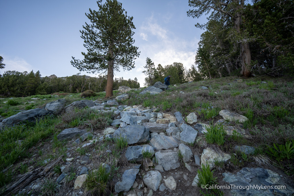
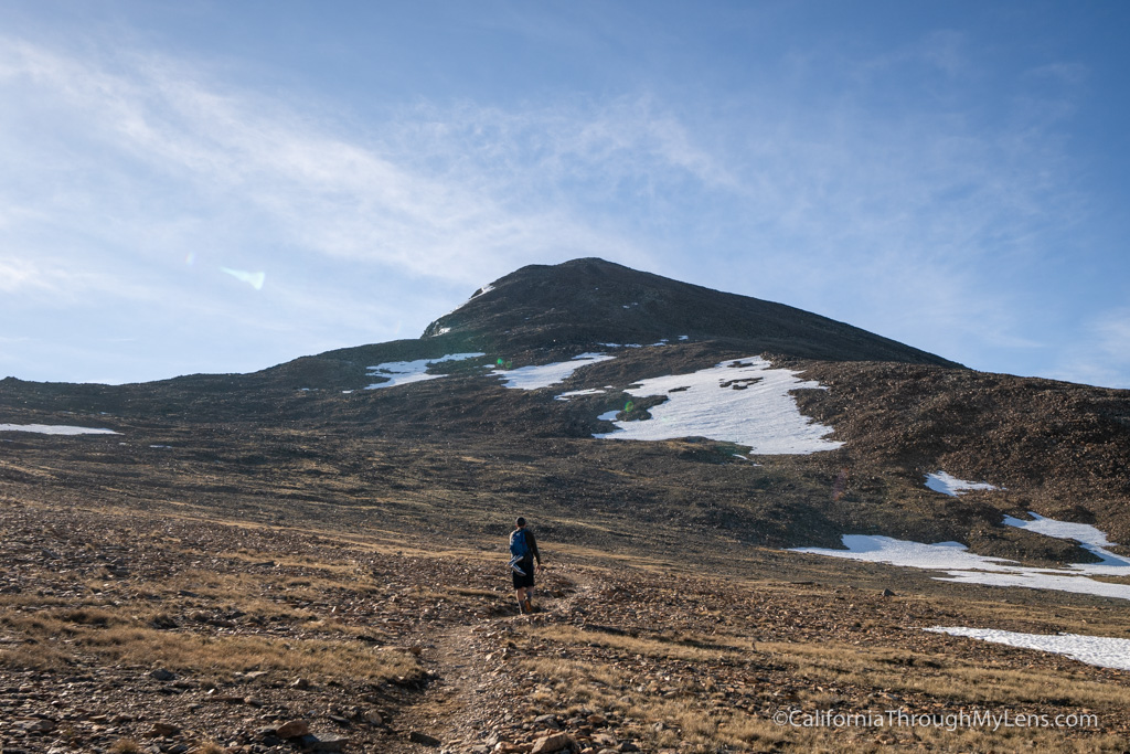
The hike heads up from here, and it has no real switchbacks for most of the trail, so it is pretty much just a steep uphill with loose rocks.
The trail is a little hard to follow here, but there were large rock piles that we could see and which noted the trail.
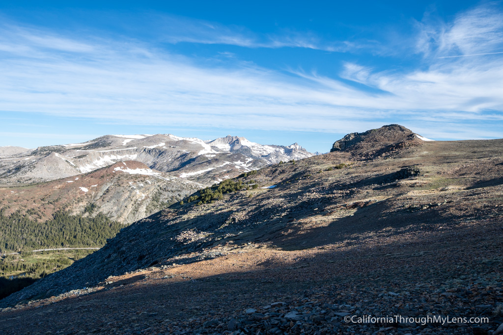
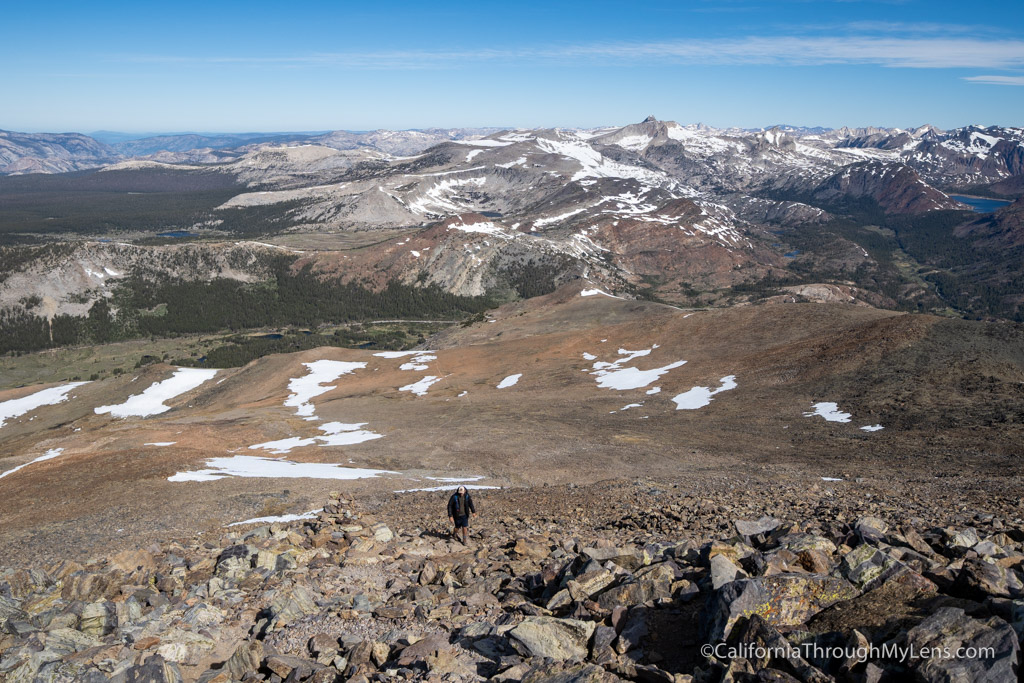
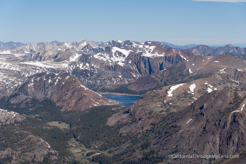
As you gain elevation, the views get better and better out into Yosemite’s backcountry.
The trailhead for the hike is located across from the Yosemite National Park entrance at Tioga Pass. You have to drive all the way up from Mono Lake to get to around 10,000 feet, which is where the hike starts. There is a parking area on the side of the road before the entrance that you can use for the hike.
At about a half mile, the trail begins to climb, and it climbs the rest of the way to the summit.
Be sure to check it out if you get the chance, and let me know what you think in the comments.
After getting to the top of the first hill, you will have a more gradual incline for a little while as you walk to the base of the Mt Dana summit.
Video
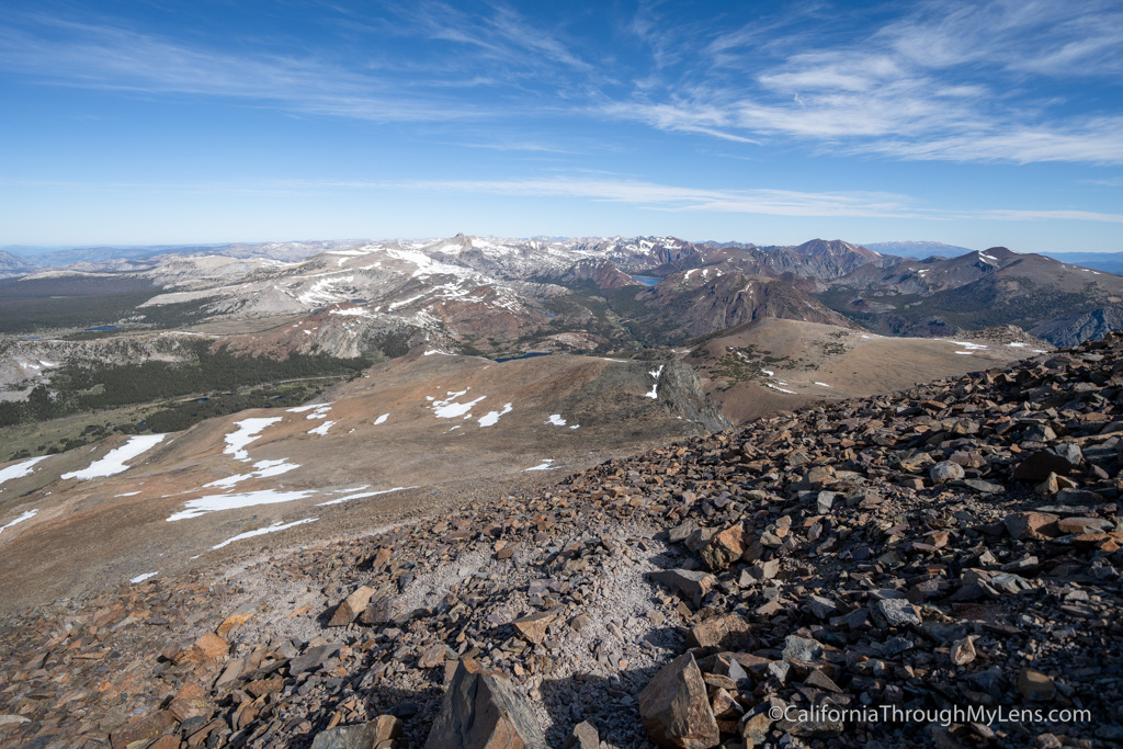
You can see Lembert Dome, Unicorn Peak, and many other peaks and lakes in the other direction.
It is stunning and a view I will never forget.
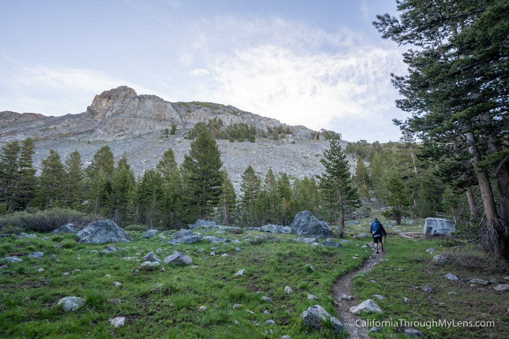
Pretty quickly, you will lose the shade and tree cover, and there is no shade the entire rest of the hike.

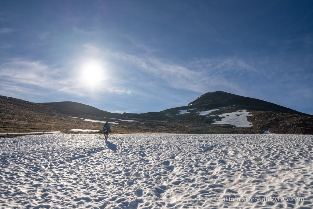
We ran into some snow at around 11,500 feet (it was early June when we hiked this), and it was easy to go around. I am sure during years with more snow, this is probably a trail where you will need an ice ax and crampons.
The hike up Mt Dana begins right at the entry station. After walking across to the trailhead, you will begin the 7 mile round trip trail to the summit.
We spent about 45 minutes up here, having a snack and just soaking it all in, and it was an amazing California adventure in Yosemite National Park.
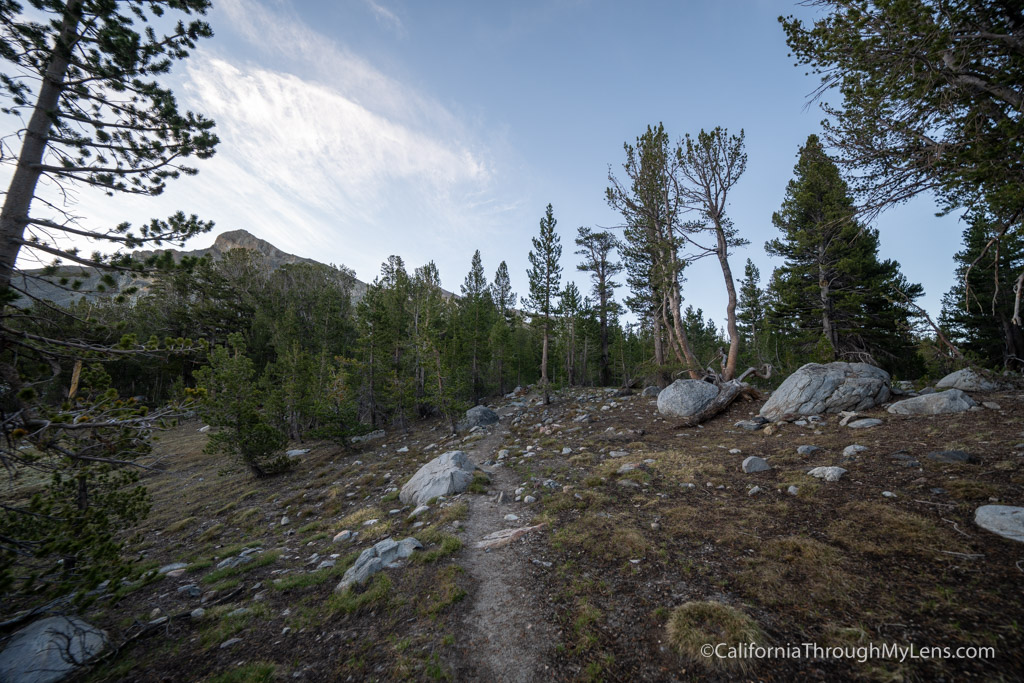
The trail begins by walking through a flat shaded area for the first half mile.